FRIENDS OF HERRING RUN PARKS
  • Home
  • About
    • Mission
    • Meet Our Board & Staff
    • Video: Tour & History of the Park
  • Impact: 2024
  • The Parks
    • HRP Master Plan
    • Trail Maps
    • Herring Run Archaeology Project
    • Host Events in Park
  • Heritage Trail at Herring Run Park
  • Events Calendar
  • Get Involved
    • Donate
    • Corporate Volunteerism
    • Volunteer
    • Follow us on FB & IG
    • Community Engagement Survey
  • Newsletter Sign up
  • Constituent Log In
  • News
  • Donate
  • Herbicide Alert
  • BCRP Forestry Management Herring Run

The Trails of Herring Run Park

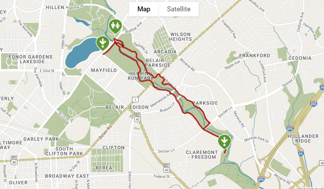
A 5.7 loop trail from Lake Montebello/ Halls Spring Area (Harford Rd & Argonne Dr.) of the park to Sinclair Lane, provides opportunities to walk or bike along the stream bed.  Multiple side hiking trails are available in the section of the park between Harford and Belair Roads.
Picture
Picture
Visit TrailLink to learn more about the trail. Also check out the TrailLink app! 

Herring Run Park Trail Map
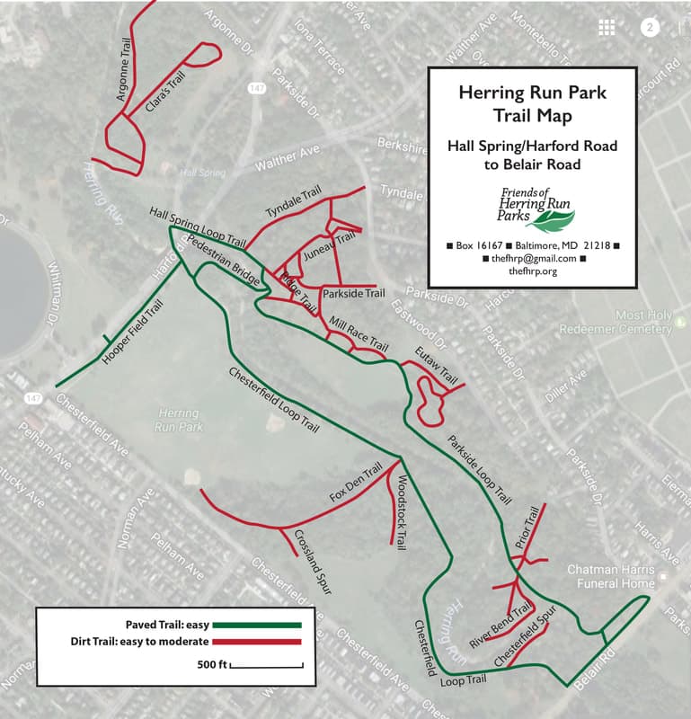
This map is of Upper Herring Run Park and shows the paved trails and a few short dirt trails.
Picture
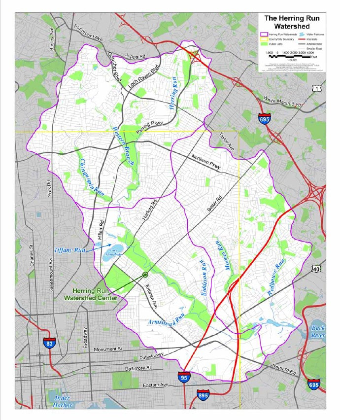
The purple lines show the areas of the Herring Run Watershed.
Picture
PO Box 16167
Baltimore, MD 21218
410-417-8565
View on Google Maps
DONATE
  • Home
  • About
    • Mission
    • Meet Our Board & Staff
    • Video: Tour & History of the Park
  • Impact: 2024
  • The Parks
    • HRP Master Plan
    • Trail Maps
    • Herring Run Archaeology Project
    • Host Events in Park
  • Heritage Trail at Herring Run Park
  • Events Calendar
  • Get Involved
    • Donate
    • Corporate Volunteerism
    • Volunteer
    • Follow us on FB & IG
    • Community Engagement Survey
  • Newsletter Sign up
  • Constituent Log In
  • News
  • Donate
  • Herbicide Alert
  • BCRP Forestry Management Herring Run